Showing 281 items matching parish plan
-
 Federation University Historical Collection
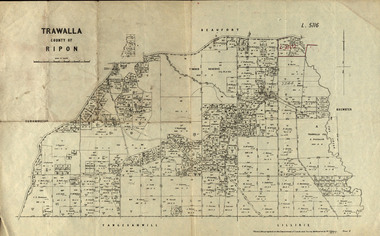
Parish Plan, Parish Plan of Trawalla in the Parish of Rippon, 1913, 28/4/1913
... Parish Plan...Parish Plan of Trawalla in the Parish of Rippon, 1913...Parish Plan of Trawalla in the Parish of Rippon. ... Plan Parish Plan of Trawalla in the Parish of Rippon, 1913 ...Trawalla is surrounded by Beaufort, Brewster, Lillirie, Yangerahwill and Eurambee.Parish Plan of Trawalla in the Parish of Rippon. trawala, ripon, westbrok, simson, mackenzie, mcarthur, wilson, nicholason, gibb, read, hayward, topper, foreman, bell, mcmillan, halpin, davis, goldsmith, trawalla pre-emptive right, butson, w.j. butson, m4471, w. read, c.a. foreman, j. simson, a. goldsmith, trawalla, g. topper -
 Yarra Ranges Regional Museum
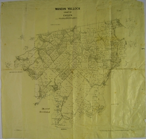
Map, H J Green, Acting Govt. Printer, Wandin Yallock, County of Evelyn (Parish Plan), c. 1910 - 1920
... Wandin Yallock, County of Evelyn (Parish Plan)...Parish Plan of Wandin Yallock. Location of Silvan Reservoir...Parish Plan of Wandin Yallock. Location of Silvan Reservoir... of Evelyn (Parish Plan) Parish Plan of Wandin Yallock. Location ...Parish Plan of Wandin Yallock. Location of Silvan Reservoir marked in ink on map.Parish Plan of Wandin Yallock. Location of Silvan Reservoir marked in ink on map. wandin yallock, maps -
 Federation University Historical Collection
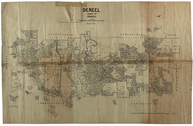
Plan, Dereel Parish Plan, 1928, 16/07/1928
... Dereel Parish Plan, 1928...parish plan...Parish Plan of Dereel showing crown allotments, dimensions... Plan Dereel Parish Plan, 1928 Parish Plan of Dereel showing ...Parish Plan of Dereel showing crown allotments, dimensions, crown grantees, dates of grant. Scale 1:31,680 WGS 84 Centroid 37 degrees 48 feet 33 inches S 143 degrees 41 feet 46 inches S NS: 6.3km EW: 15.2kmdereel, parish plan, p. mclachlan, rifle range, j. bower, dereel lagoon, t. mellington, j. mcdonald -
 Greensborough Historical Society
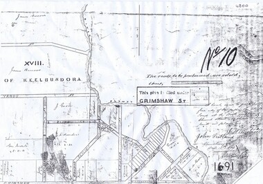
Plan, Parish Plan Map of Land North of Grimshaw Street, 11/12/1879
... Parish Plan Map of Land North of Grimshaw Street...Part of Parish plan of land north of Grimshaw Street...Photocopy of part of Parish plan of land north of Grimshaw... Plenty Lower Plenty melbourne Plan Parish Plan Map of Land North ...Part of Parish plan of land north of Grimshaw Street bounded by the Plenty River. Includes annotation signed by John Scotland and J. W. Britnell, dated Dec. 11th 1879.Photocopy of part of Parish plan of land north of Grimshaw Street bounded by the Plenty River. Includes annotation signed by John Scotland and J. W. Britnell, dated Dec. 11th 1879greensborough, grimshaw street greensborough, jonah britnell, john scotland -
 Federation University Historical Collection
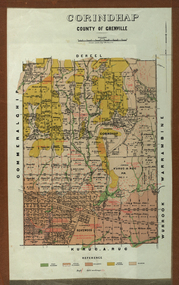
Plan - Parish Plan, Corindhap, County of Grenville, 1898
... Parish Plan...Colour Parish Plan of Corindhap, County of Grenville... Plan Plan Corindhap, County of Grenville Colour Parish Plan ...Colour Parish Plan of Corindhap, County of Grenville, and a report on the Parish.corindhap, dereel, warrambine, kuracaruc, commeralghip, rokewood, kuruc-a-ruc, w. elder, william elder, john thornly, robert cullen, davis aitcheson, robert gidney, john elder, w. barnard, anton trende, thomas hill, george hobson, h. reynolds, john collins, ironstone quarry, john jacka, patrick shanahan, murdoch mclennon, kaolinitic clay, kaolin, james holt, mary a. palmer, isaac everett, james mooney, michael cahill, fred benjamin, george hopkins, david houghton, john quarrell, j. camm, james macdonald, john thornley, break of day gully, john wilson, thomas middleton, alexander mcpherson, joseph coldwell, h. brand, pereverance co, puddling mils, mary a. stanbrook, c.w. stanbrook, eliza byrnes, james byrnes, j. maw, wallace douglas, john moffatt -
![Parish Plan [detail], Ballarat School of Mines and Surrounds](https://victoriancollections.net.au/media/collectors/4f729f6797f83e0308601707/items/5ba19e4c21ea711bb04808c5/item-media/5ba19e5e21ea711bb0481cd2/item-fit-380x285.jpg) Federation University Historical Collection
Federation University Historical CollectionParish Plan [detail], Ballarat School of Mines and Surrounds
... Parish Plan [detail]...parish plan... Technical School. parish plan ballarat school of mines ballarat ...Copy of a section of a Ballarat Parish Plain showing the Ballarat School of Mines, Wesleyan Church Reserve, Ballarat Gaol Reserve, Ballarat Technical School.parish plan, ballarat school of mines, ballarat junior technical school, lydiard street south, grant street, albert street, united welsh protestant church, armstrong street south, hickman street, ballarat gaol -
 Greensborough Historical Society
Maps, Greensborough. Parish Plan 1860, 1860c
... Greensborough. Parish Plan 1860...Enlargements of Parish plan circa 1860?... Plenty Lower Plenty melbourne Maps Greensborough. Parish Plan ...This plan show Green's subdivision of Greensborough, north of Grimshaw Street.Enlargements of Parish plan circa 1860?One copy possibly from 1860, containing lot numbers for a government road, now Main Street, and surrounding streets.greensborough, grimshaw street greensborough, edward bernard green -
 Rutherglen Historical Society
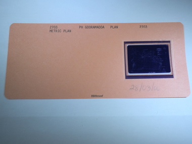
Aperture Card microfilm, Victorian Land Tiltes Office, Parish Plan Gooramadda, 28/03/2000
... Parish Plan Gooramadda...Parish Plan of Gooramadda...-country Aperture Card microfilm Parish Plan Gooramadda card ...Parish Plan of Gooramaddacard with a single microfilm insertplan, lots, roads, boundary -
 Rutherglen Historical Society
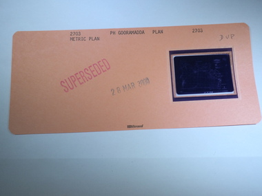
Aperture Card microfilm, Victorian Land Tiltes Office, Parish Plan Gooramadda (Superseded), 28/03/2000
... Parish Plan Gooramadda (Superseded)...Parish Plan of Gooramadda...-country Aperture Card microfilm Parish Plan Gooramadda (Superseded ...Parish Plan of Gooramaddacard with a single microfilm insertplan, lots, roads, boundary -
 Rutherglen Historical Society
Aperture Card microfilm, Victorian Land Tiltes Office, Parish Plan Gooramadda (Superseded)
... Parish Plan Gooramadda (Superseded)...Parish Plan of Gooramadda...-country Aperture Card microfilm Parish Plan Gooramadda (Superseded ...Parish Plan of Gooramaddacard with a single microfilm insertplan, lots, roads, boundary -
 Federation University Historical Collection
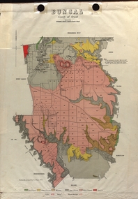
Map - Plan, E.J. Dunn, Bungal County of Grant Parish Plan
... Bungal County of Grant Parish Plan...E.J. Dunn was tje surveyor of this parish plan....E.J. Dunn was tje surveyor of this parish plan. plan bungal ...E.J. Dunn was tje surveyor of this parish plan.Colour geological plan of Bungal in the County of Grant, Victoria. The areas circled in red ar craters.plan, bungal, bungeltap, black horse co. egerton, egerton, mount egerton, sister rose shaft, south learmonth co, kerrit bareet, bungaeeltap, yaloak, eastern moorabool river, corong, bungal station preemptive right, lal lal, western moorabool river, moorabool rover, borhoneychurck, mount egerton battery, bungal creek -
 Tatura Irrigation & Wartime Camps Museum
Map, Part Murchison North Parish Plan
... Part Murchison North Parish Plan .... Part Murchison North Parish Plan with extent of "Kiota... Tatura the-murray Map Part Murchison North Parish Plan Ownership ...Ownership detail obtained from S.R. & W.S.C. rate book 1933. Part Murchison North Parish Plan with extent of "Kiota" property outlined, as in 1933, owned by Gerald N. Buckley, purchased in 1936 by Pargeter, and held until 1943. Note that Kiota Road west of the Tatura Murchison Road was unfenced in those years.kiota estate, pargester,buckley, dhurringile. -
 Federation University Historical Collection
Plan, Camp Street Ballarat Parish Plan
... Camp Street Ballarat Parish Plan... Plan Camp Street Ballarat Parish Plan PLan of Camp Street ...PLan of Camp Street Ballaratcamp street, police reserve, old colonists' association, grenville street, lydoard street north -
 Rutherglen Historical Society
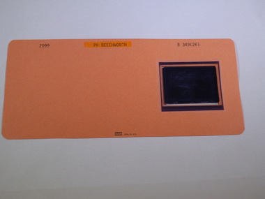
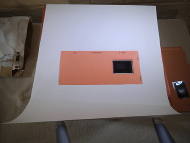
Aperture Card microfilm, Victorian Land Tiltes Office, Parish Plan Beechworth
... Parish Plan Beechworth...-country Aperture Card microfilm Parish Plan Beechworth card ...Town layout of Beechworthcard with a single microfilm insertplan, town, boundries, lots, roads -
 Rutherglen Historical Society
Aperture Card microfilm, Victorian Land Tiltes Office, Parish Plan Beechwoth
... Parish Plan Beechwoth...-country Aperture Card microfilm Parish Plan Beechwoth card ...Town layout of Beechworthcard with a single microfilm insertplan, town, boundries, lots, roads -
 Rutherglen Historical Society
Aperture Card microfilm, Victorian Land Tiltes Office, Parish Plan Beechwoth
... Parish Plan Beechwoth...-country Aperture Card microfilm Parish Plan Beechwoth card ...Town layout of Beechworthcard with a single microfilm insertplan, town, boundries, lots, roads -
 Rutherglen Historical Society
Aperture Card microfilm, Victorian Land Tiltes Office, Parish Plan Beechwoth
... Parish Plan Beechwoth...-country Aperture Card microfilm Parish Plan Beechwoth card ...Town layout of Beechworthcard with a single microfilm insertplan, town, boundries, lots, roads -
 Rutherglen Historical Society
Aperture Card microfilm, Victorian Land Tiltes Office, Parish Plan Beechwoth, 5/06/1990
... Parish Plan Beechwoth...-country Aperture Card microfilm Parish Plan Beechwoth card ...Town layout of Beechworthcard with a single microfilm insertplan, town, boundries, lots, roads -
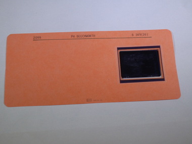
 Rutherglen Historical Society
Aperture Card microfilm, Victorian Land Tiltes Office, Parish Plan Beechwoth, 4/07/1991
... Parish Plan Beechwoth...-country Aperture Card microfilm Parish Plan Beechwoth card ...Town layout of Beechworthcard with a single microfilm insertplan, town, boundries, lots, roads -
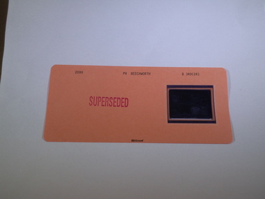
 Rutherglen Historical Society
Aperture Card microfilm, Victorian Land Tiltes Office, Parish Plan Beechwoth (Superseded)
... Parish Plan Beechwoth (Superseded)...-country Aperture Card microfilm Parish Plan Beechwoth (Superseded ...Town layout of Beechworthcard with a single microfilm insertplan, town, boundries, lots, roads -
 Rutherglen Historical Society
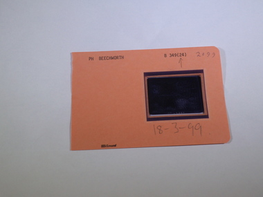
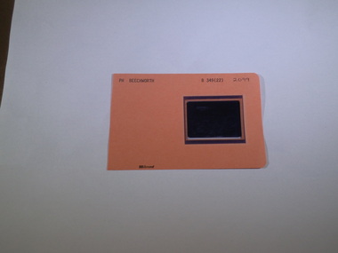
Aperture Card microfilm, Victorian Land Tiltes Office, Parish Plan Beechworth, 18/03/1999
... Parish Plan Beechworth...-country Aperture Card microfilm Parish Plan Beechworth card ...Town layout of Beechworthcard with a single microfilm insertplan, town, boundries, lots, roads -
 Rutherglen Historical Society
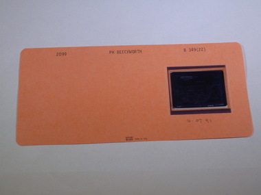
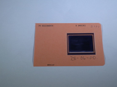
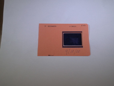
Aperture Card microfilm, Victorian Land Tiltes Office, Parish Plan Beechworth, 28/06/2000
... Parish Plan Beechworth...-country Aperture Card microfilm Parish Plan Beechworth card ...Town layout of Beechworthcard with a single microfilm insertplan, town, boundries, lots, roads -
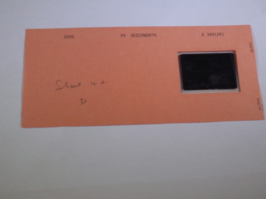
 Rutherglen Historical Society
Aperture Card microfilm, Victorian Land Tiltes Office, Parish Plan Beechworth (Duplicate)
... Parish Plan Beechworth (Duplicate)...-country Aperture Card microfilm Parish Plan Beechworth (Duplicate ...Town layout of Beechworthcard with a single microfilm insertplan, town, boundries, lots, roads -
 Rutherglen Historical Society
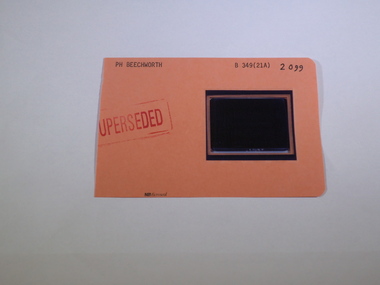
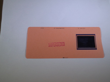
Aperture Card microfilm, Victorian Land Tiltes Office, Parish Plan Beechworth (Superseded)
... Parish Plan Beechworth (Superseded)...-country Aperture Card microfilm Parish Plan Beechworth (Superseded ...Town layout of Beechworthcard with a single microfilm insertplan, town, boundries, lots, roads -
 Rutherglen Historical Society
Aperture Card microfilm, Victorian Land Tiltes Office, Parish Plan Beechworth (Superseded)
... Parish Plan Beechworth (Superseded)...-country Aperture Card microfilm Parish Plan Beechworth (Superseded ...Town layout of Beechworthcard with a single microfilm insertplan, town, boundries, lots, roads -
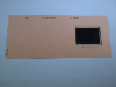
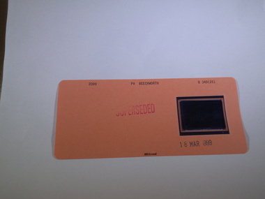
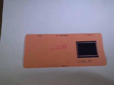 Rutherglen Historical Society
Aperture Card microfilm, Victorian Land Tiltes Office, Parish Plan Beechworth (Superseded), 18/03/1999
... Parish Plan Beechworth (Superseded)...-country Aperture Card microfilm Parish Plan Beechworth (Superseded ...Town layout of Beechworthcard with a single microfilm insertplan, town, boundries, lots, roads -
 Rutherglen Historical Society
Aperture Card microfilm, Victorian Land Tiltes Office, Parish Plan Beechworth (Superseded)
... Parish Plan Beechworth (Superseded)...-country Aperture Card microfilm Parish Plan Beechworth (Superseded ...Town layout of Beechworthcard with a single microfilm insertplan, town, boundries, lots, roads -
 Rutherglen Historical Society
Aperture Card microfilm, Victorian Land Tiltes Office, Parish Plan Beechworth
... Parish Plan Beechworth ...-country Aperture Card microfilm Parish Plan Beechworth card ...Town layout of Beechworthcard with a single microfilm insertplan, town, boundries, lots, roads -
 Rutherglen Historical Society
Aperture Card microfilm, Victorian Land Tiltes Office, Parish Plan Beechworth (Superseded)
... Parish Plan Beechworth (Superseded)...-country Aperture Card microfilm Parish Plan Beechworth (Superseded ...Town layout of Beechworthcard with a single microfilm insertplan, town, boundries, lots, roads